


The European Space Agency's Earth-monitoring Sentinels collected
radar interferometry of the Napa Valley before and after the recent
earthquake highlighting ground deformation.
Ground-truthing of surface ruptures is drawing a surprisingly
complex picture of valley faults.
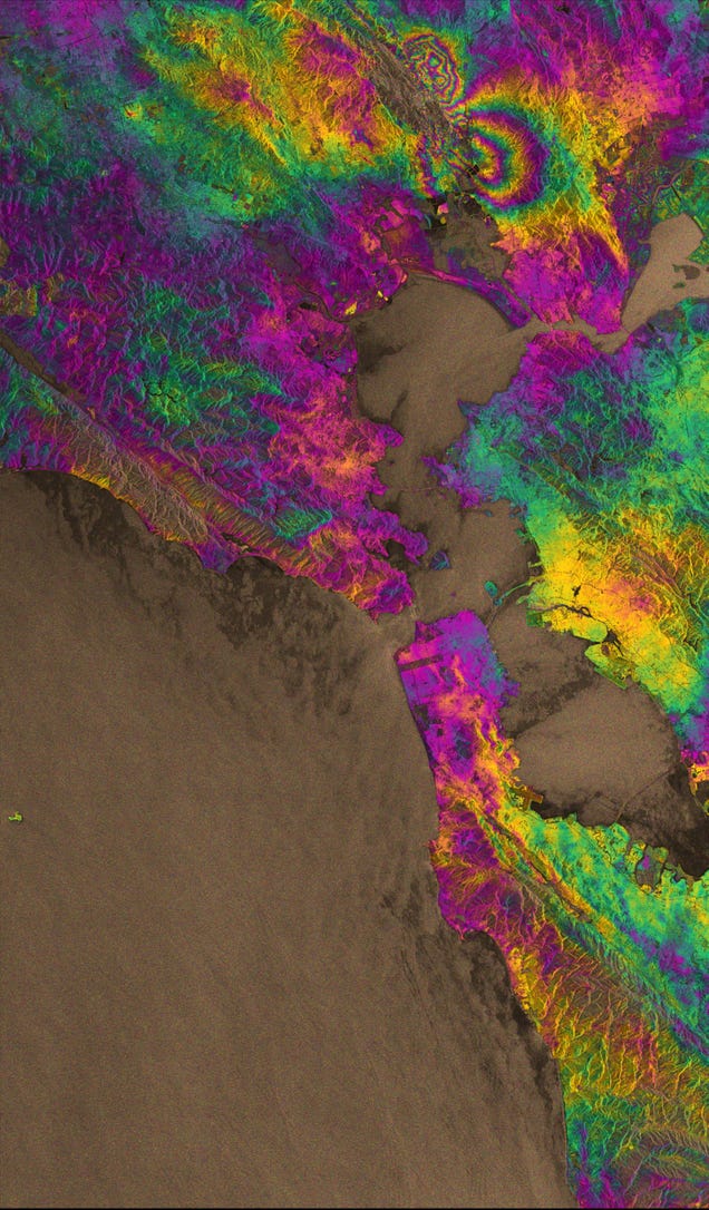
The image above was created by comparing radar images
from August 7 and 31, 2014.
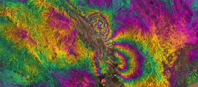
The two round shapes around Napa valley indicate the
degree to which the ground moved during the earthquake.
Each colour cycle corresponds to a deformation
of 28 mm ( 1.10 Inches )
The maximum deformation is more than 10 centimeters
(3.9 Inches), and an area of about 30x30 km (18.64 Miles)
was affected.
of 28 mm ( 1.10 Inches )
The maximum deformation is more than 10 centimeters
(3.9 Inches), and an area of about 30x30 km (18.64 Miles)
was affected.
The visualization also maps the infamous San Andreas Fault
which runs along the coastline.
Regards.which runs along the coastline.
Last edited: